Use of the Pikalert® System in the Wyoming Department of Transportation Connected Vehicle Pilot Deployment
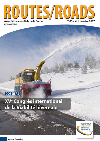
Rural Wyoming is strongly impacted by hazardous weather along its road network. Interstate 80 (I-80) is a major highway that runs west to east along the southern part of the state, which is located in the Northern Rocky Mountain area of the U.S. illustration 1. The entirety of I-80 in Wyoming is over 1,800 meters in elevation, with a maximum of 2,633 meters. This elevation and Wyoming’s continental, northerly climate lead to extreme weather along I-80 throughout the year.
-
Information sheet
- Date: 2017
- Author(s): Siems-Anderson Amanda / WIENER Gerry / Brummet Thomas / Linden Seth / Petzke William / McCarthy Padhrig / Garcia Vince / Ragan Ali / English Tony / Gopalakrishna Deepak / Hsu Eva
- Domain(s): Winter Service
- Type: RR375 - Features
- PIARC Ref.: RR375-027
- Number of pages: 5
-
This article has been published in the Routes/Roads magazine